Explore comprehensive ZIP code demographic data in a spreadsheet. This dataset provides a list of all U.S. ZIP codes with their state, town, county, and metro area. It also has population by ZIP code and detailed U.S. Census data by ZIP code for age, gender, and race. Explore for free in Row Zero, a next-gen spreadsheet built for big data.
Open ZIP Code Demographics Dataset
Dataset Summary
This spreadsheet includes several different sheets of U.S. ZIP Code data from the U.S. Census Bureau. It also includes ZIP code mappings to state, county, town, metro, and congressional district. 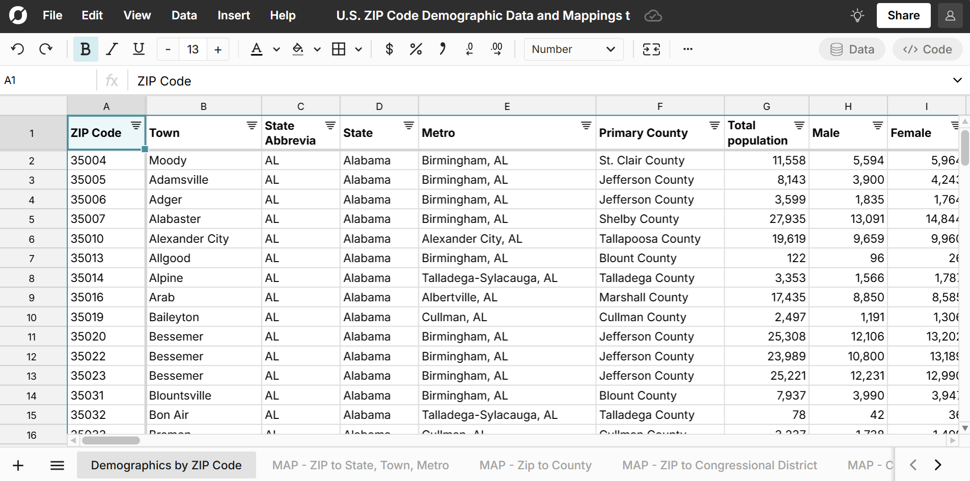
ZIP code demographic data includes ZIP code population by age, gender, and race with both raw counts and percentages. It also includes median household income by ZIP code and counts for U.S. Citizens of voting age. 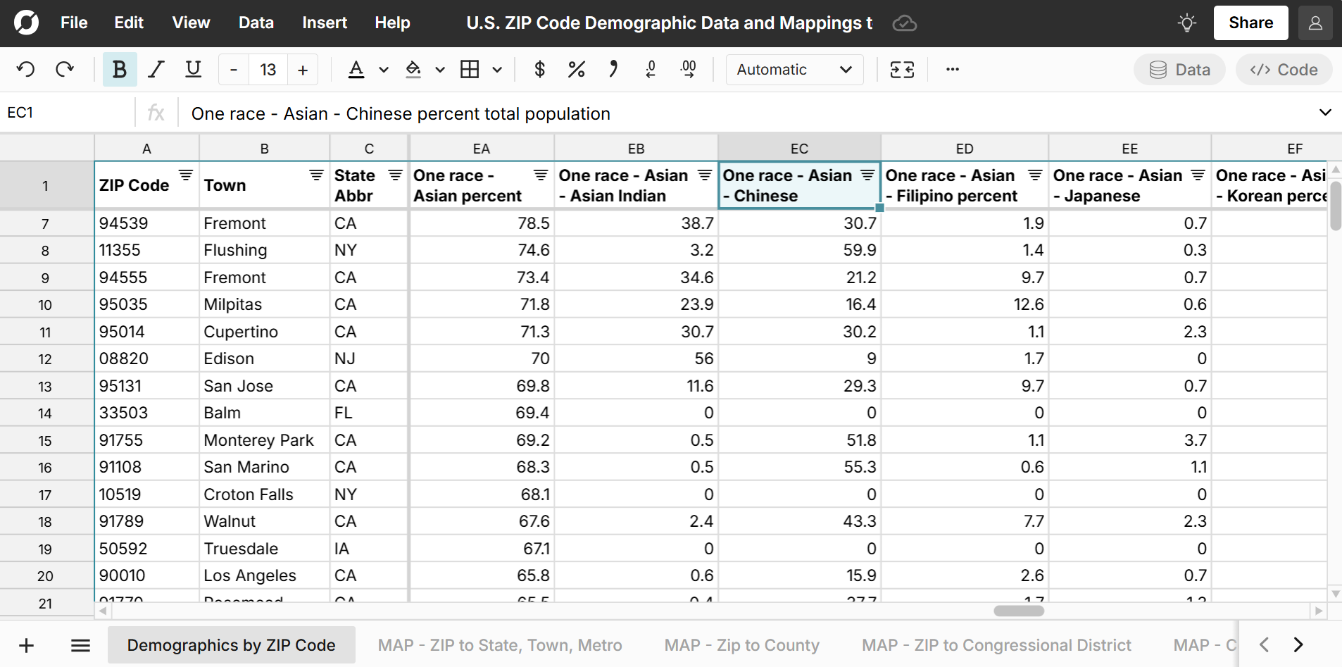
The workbook contains the following sheets:
- Demographics by ZIP Code
- Map ZIP to State, Town, Metro
- Map ZIP to County
- Map Zip to Congressional District
- Map County to ZIP
- Map Metro to ZIP
- Map Congressional District to ZIP
- Overall U.S. Demographics
Note: You can access a comprehensive dataset of income by ZIP code here.
Highlights from the Dataset:
Largest ZIP Codes in the U.S.
- 77494 Katy, TX, Fort Bend County with a population of 137,213
- 08701 Lakewood, NJ, Ocean County with a population of 136,784
- 77449 Katy, TX, Harris County with a population of 123,042
- 78660 Pflugerville, TX, Travis County with a population of 118,437
- 77433 Cypress, TX, Harris County with a population of 112,211
- 60629 Chicago, IL, Cook County with a population of 109,292
- 77084 Houston, TX, Harris County with a population of 109,115
- 11368 Corona, NY, Queens County with a population of 107,060
- 11208 Brooklyn, NY, Kings County with a population of 106,901
- 79936 El Paso, TX, El Paso County with a population of 104,427
Compare this to the median ZIP code population of 2,654 residents.
You can also easily filter the spreadsheet to see the largest ZIP codes by state, county, and metro.
Use Cases for this Dataset
Row Zero is a powerful spreadsheet built for big data, so you can easily import your data into the spreadsheet (or vice versa) to map your data or just start exploring this comprehensive ZIP Code dataset with charts and pivot tables. Here are a few common use cases:
- Lookup population by ZIP code and filter, sort, and pivot to quickly analyze the data.
- Rank ZIP codes by state, county, and metro by size and percent breakdown for characteristics like age, gender, and race.
- Enrich your current datasets with ZIP code data. You can use XLOOKUP to join datasets or import ZIP code data directly to your database or data warehouse.
- Calculate market penetration by ZIP code. Measure your user counts or sales by ZIP Code vs ZIP code population counts to see your ZIP code market penetration. You can use the detailed demographic breakdowns to measure more advanced cohorts by gender, age, and race.
- Evaluate the diversity of each ZIP code by race, gender, and age.
Data Sources
Data sources for this ZIP code demographics dataset include the U.S. Census Bureau 5-year estimate tables from the American Community Survey, as well as the U.S. Office of Housing and Urban Development. Data has been updated as of February 2025 with the most recent data available.